9 Ways Drones are Disrupting Agriculture

There’s a lot more to farming than just planting seeds, watering them and picking them once they’ve grown. And with the widespread adoption of drones, agriculture is getting even more precise and efficient.

agriculture-drone.jpeg

1. Fighting Crop Diseases

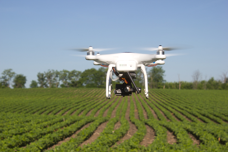
Drones can be used for multispectral imaging, outfitted with crop health sensors that run NDVI (normalized difference vegetation index). Aerial NDVI sensors aren’t totally new — they used to be outfitted to manned airplanes — but with drones, they are quicker and cheaper.

2. Fertilizer

NDVI is used for more than just analyzing diseases. NDVI images may be able to prescribe fertilizer applications, estimate yields and identify weeds. (NDVI is an important graphical indicator for farmers to analyze remote sensing measurements and assess whether the land contains live green vegetation or not.)

3. NIR Sensors

Similar to NDVI, near-infrared sensors can determine plant health based on light absorption.

4. Pollination

Drone companies such as Bee Innovative have been tracking honeybees in real time for precision pollination. Bee Innovative claims that its “BeeDar” solution has already delivered 20 percent increases in crop yields and returns for farmers season to season. And California-based agriculture technology startup DropCopter allows farmers to pollinate orchards via drones.

5. Food Security

Whether it’s generating more vegetables, fruits or even coffee beans, drones are able to maximize crop yields. There’s no better example of that than the work being done by Lyela Mutisya, who is using drones to help her father’s coffee farm in Kenya. She said many Kenya farms can’t afford fertilizer (a well-managed coffee farm can produce up to 30 pounds of coffee per tree, but a coffee farm that can’t afford fertilizer produces more like 5 pounds of coffee per tree). Drone technology is effective at collecting data to help coffee farmers improve crop health. They can have a role in efficient crop scouting, earlier yield predictions, earlier crop stress detection, enhanced irrigation management and control, and more precise nutrient and chemical applications.
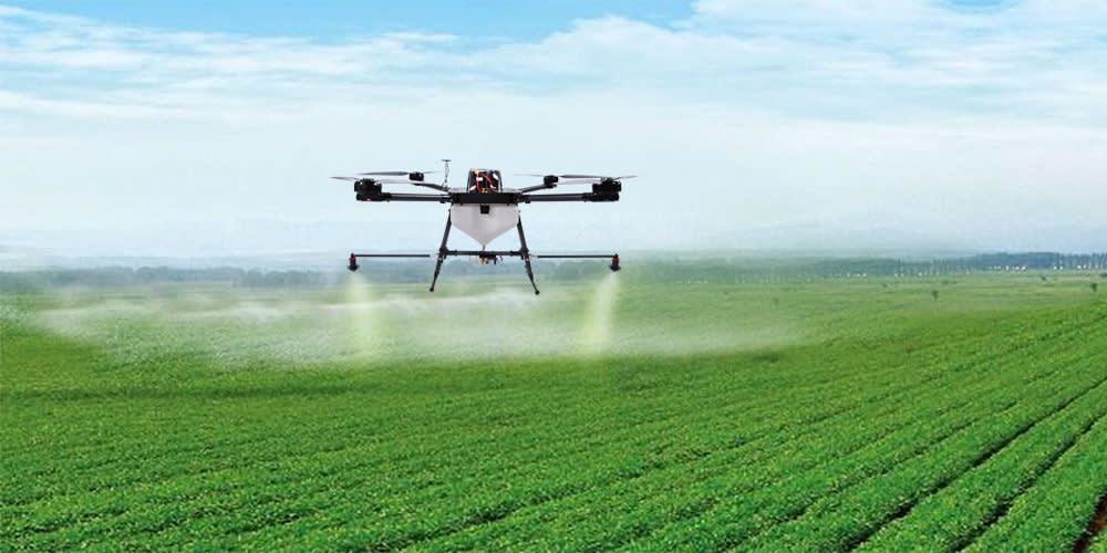
6. Pesticides

And on that note, pest and decision control is very important in coffee farming, as well as all other types of agriculture. Pests can cause an 80% loss in coffee trees. That alone can significantly hurt a coffee farm. If a tree were to get infected and lose 80% of their crop, a drone can help prevent that.

7. Herbicides

In fact, DJI launched its own crop spraying drone back in November 2015.

8. Thermal Cameras

In December 2015, DJI announced a collaboration with Flir Systems Inc., an Oregon-based sensor manufacturer that focuses on thermal imaging. In agriculture, farmers use thermal imaging as they fly over fields to indicate dry spots, over-watering, crop height or pesticide use.

9. Planting Seeds

Companies such as DroneSeed are building drones that can blast fertilizer and seeds into the ground at 350 feet per second. DroneSeed says its solution is good for the environment, worker safety and investors. DroneSeed’s drones currently have a flight time of about 30 minutes; after changing batteries, the drones can cover an acre within 1.5 hours.

View the full article by drone girl here

5 Ways We Can Help Farmers this Spring

Throughout the whole growing season, drone images can be a good tool for farmers to make their work more effective. Already in spring, drones can be used in the field to help answer important questions: How was the establishment of winter crops and how has the winter affected the crops? Where do I need to reduce or increase the seed rate next time? Should I change the time of fertilization? Where do I have weed problems?


Drone image showing variations in establishment

Evaluate Crop Establishment

Before winter wheat begins to grow and enter stroke phase, a map based on drone imagery can help evaluate how even the crop is within the field. It can show parts of the field with thinner and denser crop and can serve as a good guide where to look at during the field walks in order to establish the reason for variations.


Variable Rate Fertilizer Application

Drone imagery collected early in the spring can help determine if there are thinner parts of the field that would benefit from early nitrogen application to facilitate the development of roots and side shoots, especially for late sown and slightly sparse stocks.

 
Drone imagery shows variations in crop establishment

Drone imagery shows variations in crop establishment

Variable Rate Seeding

In case drone images capture the variation in crop establishment and/or soil differences, this can be in future used as a basis for variable rate seeding.

NDVI-index from drone imagery shows variations in crop establishment Areas of poor establishment, often on stiffer soil, should be sown considerably thicker than lighter soils, where you may instead get too dense and vigorous crops which may result in crop lodging. Areas with more clayey soil have also generally higher crop potential than areas with coarser soil texture.


Drone image shows weed spread in the field

Weed Control

Drone image shows weed spread in the field With a high definition RGB camera on a drone, it is relatively easy to map weed spread. This information can then be used during the field walks. In parts where the drone images show that the weed spread is low, you may not need to make any treatment at all. It is also possible to create a variable rate application file and thus reduce the use of herbicides, benefiting both the environment and economy.


Inspect Drainage

When the soil dries up in the spring, the drainage system can sometimes be clearly seen, as the soil above the drainage pipes dries up first. Drone images collected on one of these days can be used to make new drainage maps and evaluate how the drainage system works. If the soil type is similar across the field, then the drying should also be fairly even. If the drone maps show areas that dry significantly slower, it may be a sign that something is wrong with drainage system and further investigation may be performed.


Drone images collected at the right point in time can help decide correct nitrogen rate or vary seed rate during sowing and thus achieve more even crops with higher yield potential. We can makes it easy to turn drone images into valuable insights and prescription files that can be directly used in the field.

Why a Farmer Should Hire a Drone

What in the world would a farmer do with a drone?

Quite a bit actually, the limit is 400' and your imagination.

  • Check crops, irrigations, ditches, grain bins, & animals
  • Record drainage tile, problem areas, and mark wet spots
  • Train new recruits with a new perspective to show them the ropes
  • The list goes on and on but the most important thing is that if you are a farmer, you need to hire a drone!

Seven Ways to Use Drone Mapping on the Farm This Season

As one ag industry expert put it, using a drone on the farm is like being able to see your field from a 10,000-foot altitude, but also being able to zoom in to two inches above the plants. Growers are increasingly discovering that drone mapping is an invaluable tool, both for its ease of use, and for its many applications on the farm.

1. Crop Scout to Detect Parasites and Fungi

Using drone mapping to pinpoint plant health issues such as parasites and fungi.

2. Compile Plant Counts

One of the most exciting uses for drone mapping in agriculture is the ability to conduct complete, accurate plant counts.

3. Analyze Stand Establishment

In addition to plant counts, corn and soybean growers are using drone mapping to analyze stand establishment of newly planted crops to decide whether they need to replant certain areas.

4. Generate Variable Rate Prescriptions for Nitrogen and Pesticides

Drone maps provide a rich amount of data that can be used to make more informed decisions about issues like crop reseeding and targeted nutrient applications.

5. Assess and Clean-up Damage After a Storm

Generate a detailed Skymatics crop damage report

6. Negotiate Fair Crop Loss Percentages

Detailed information provided by drone map, gives an adjustor a second look at targeted areas and ultimately offere a far higher loss percentage.

7. Assess Slope and Drainage After the Harvest

Drone-generated elevation map can give a sense of the slope and drainage of a field. Paired with volume measurement tools, growers can plan the cut and fill of future terraces and waterways.

Read More

Drone Precision Sprays Pesticides on Crops

Drones are a tool of precision. Flying overhead, their cameras scan for targets. The agri-drone is a small-scale adaptation of the same premise. Developed by researchers at Japan’s Saga University, the agri-drone scans crops for clusters of bugs, and then delivers a precision dose of pesticide to the plant-eating critters below.

Read More on Popular Science

Growers and Drone Mapping

Growers are using drone mapping in so many ways — for crop scouting, to generate variable rate prescription maps, to compare soil data to plant health, and much more. At the core, drone mapping helps growers detect variation in their fields.

Being able to see variation not only helps growers diagnose problems, but also helps them evaluate whether solutions are working. Using drone mapping on both fronts to help demonstrate the value of their products and boost sales.

Read More

Drone Giant DJI Moves to the Farm

Farmers were some of the earliest civil adopters, using drones to identify differences in crop conditions.

Yamaha Motor Co. has been dusting crops in Japan with UAVs for more than two decades. With the cost dropping for cargo-carrying drones, DJI and others are building crop-spraying and remote sensing vehicles that can help reduce chemical use and improve yields. It has been estimated that precision agriculture will account for about 80 percent of the U.S. market for commercial UAVs.

Last year the U.S. Federal Aviation Authority issued the first exemption for agricultural drone use outside of university research. DJI released its eight-rotor Agras MG-1 last year, with a 10-kilogram tank, followed by a thermal-imaging camera for remote sensing. It’s up against companies like Yamaha and local rivals like Shenzhen MicroMultiCopter Aero Technology Co.

Read more on AGWeb