

we are looking for breathtaking photos that capture the world from above. This could include photos taken by drones, aerials taken from up high, or even photos that capture amazing people, places or things in detail that exist below you and your camera. Think outside the box and take the photo as close up or far away from your subject as you want (so long as seen from above)!
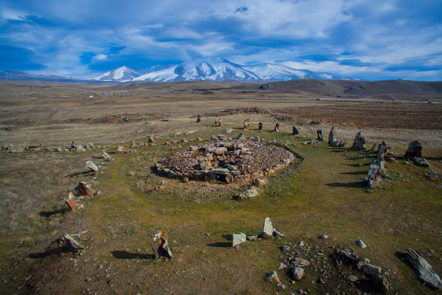
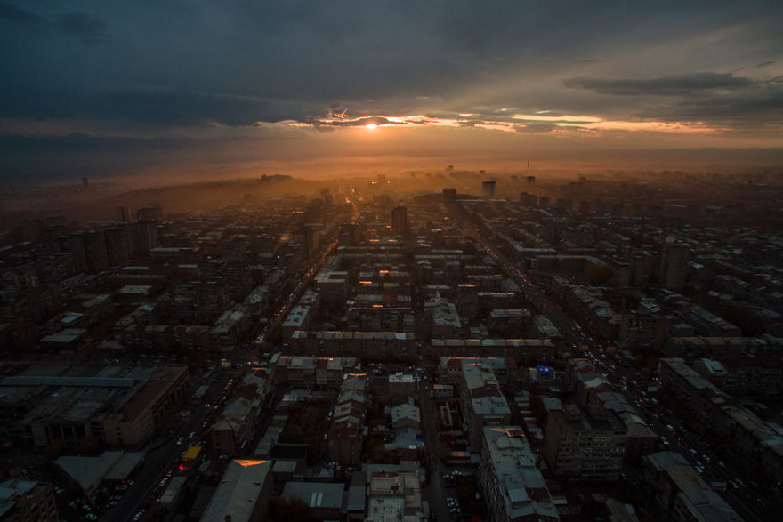
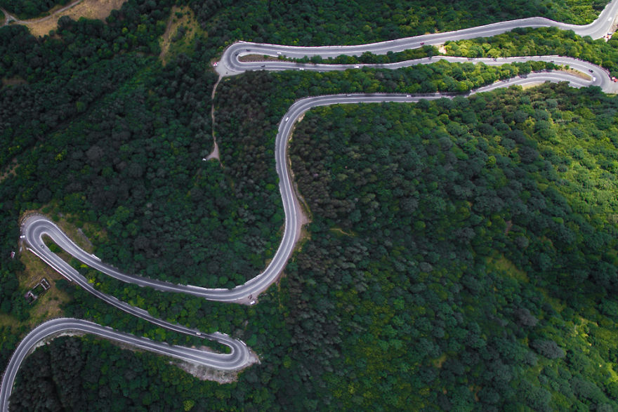
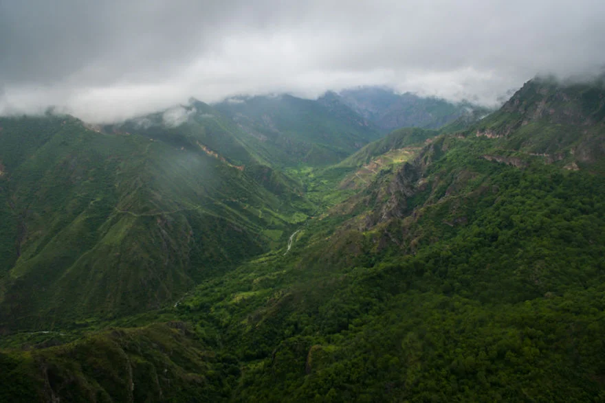
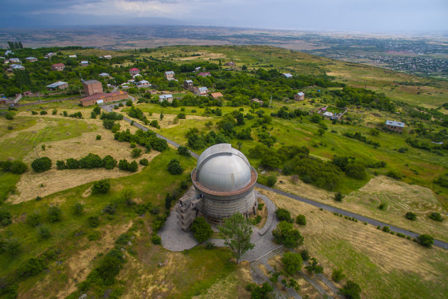
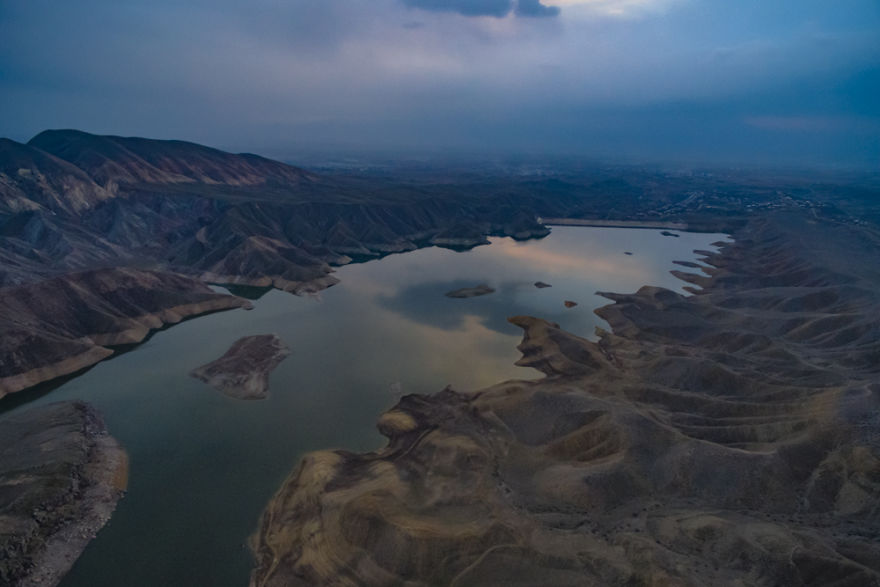
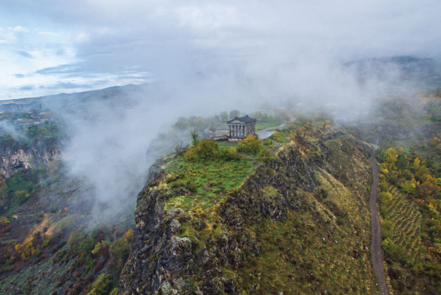
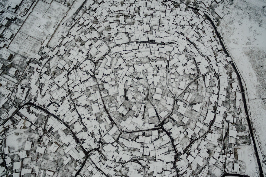
Stunning Photos of Armenia Captured by a Drone


Uluru Drone Footage Reveals Never-before-seen Views
The 550m-year-old Australian sandstone monolith can be seen from a new perspective captured by the first drone to operate under permit inside Uluru-Kata Tjuta national park.
WRC Looks Better Than Ever

The footage drones produce can be beautiful. Being able to fly on a completely different parallax, easily adjusting height and speed, all gives an intensely visually stimulating image. So when this is paired with chasing a mud-slinging rally car, drones give depth and a rawness that a man in the helicopter or the muddy guy with the tripod just can’t.
See more at Top Gear
The Top Panoramic Photos Taken With Drones

The pieces featured in SkyPixel’s contest show that there’s opportunity for 360-degree photography to enable new types of art. As 360-degree cameras and drones become cheaper and more accessible, we’re bound to see more similar creations emerge. Explore the winning shots below by moving your mouse cursor or finger around the image.
Drone Shows Incredible Extent of Flooding in Louisiana
Catastrophic flooding hit southern Louisiana this weekend, displacing thousands of residents and killing at least six people.
Drone footage of flooding near Interstate 12 in Hammond, Louisiana, posted to YouTube on Saturday shows rainwater affecting entire neighborhoods, partially submerging cars, trucks and houses.
Navigating the FAA’s New Drone Rule for Realtors
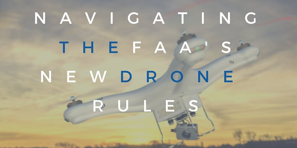
Real estate professionals hoping to use drones in their business got some big news when the Federal Aviation Administration released a final rule governing the commercial use of small unmanned aircraft systems. This final rule, effective August 29, 2016, includes some hard-fought wins for the National Association of REALTORS®, and a clearer path for people to put drones to use in their businesses.
The new rule will no longer require a small unmanned aircraft operator to hold a FAA-issued pilot’s license. Instead, the final rule requires a person operating a small uas to either hold a remote pilot certificate with a small uas rating or be under the direct supervision of someone who does. This new remote pilot certificate will be less expensive and less time-consuming to obtain – a major victory for aspiring drone users.. In general, small UAS may only be flown during the daytime, and cannot be flown over non-participants, and the small UAS must be within the visual line of sight of the operator at all times.
To learn more about the rule, and the significant changes for Realtors
Stunning Look of Indiana Tornado by Drone
Drone catches the large funnel cloud as it travels across some farmland.
Drone Journey Into One of World’s Largest Caves
Equipped with a drone and camera gear, photographer Ryan Deboodt spent eight days camped inside Vietnam's Son Doong Cave and captured amazing footage. Some of the massive caverns in Son Doong, one of the world's largest caves, are almost 500 feet (150 meters) wide and 650 feet (200 meters) high, large enough to accommodate a Boeing 747.
Amazing Travel Videos by Drone
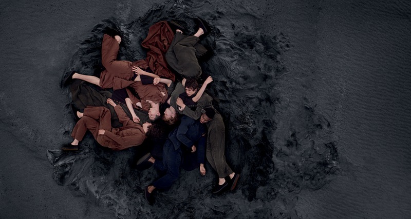
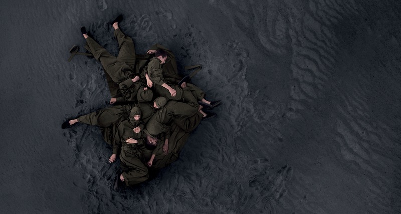
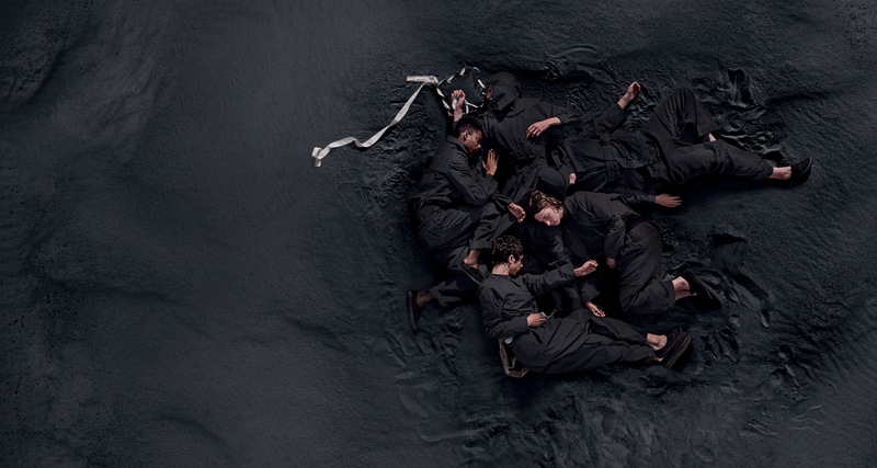
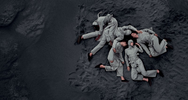
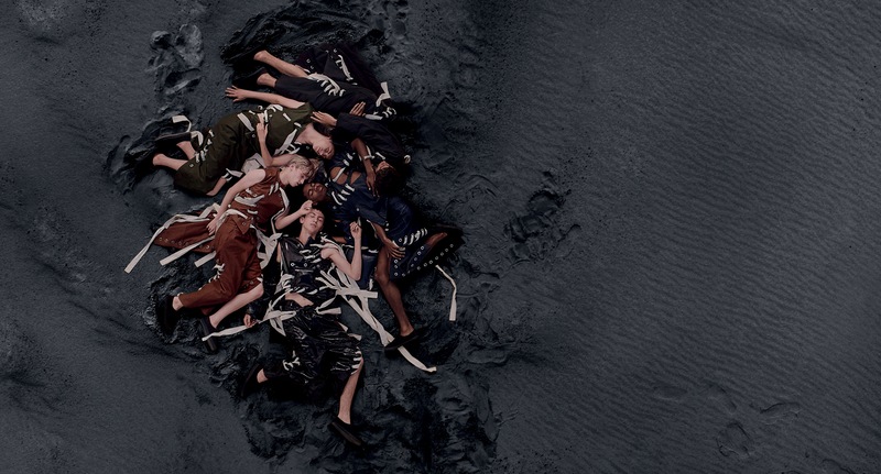
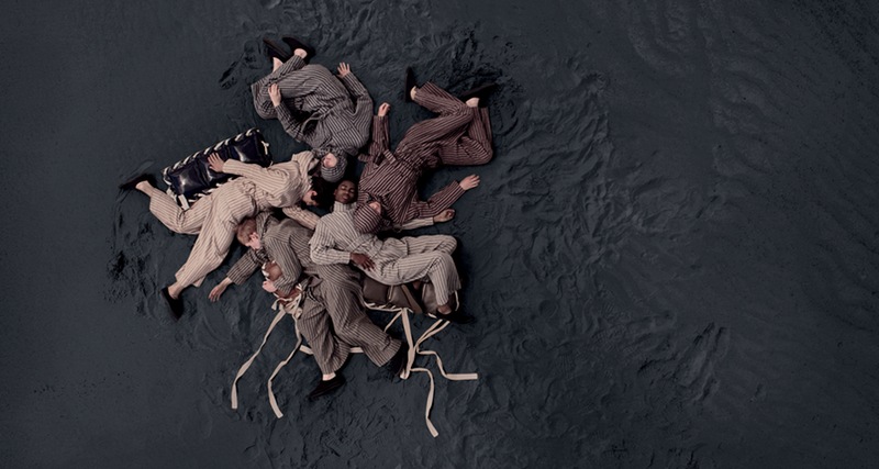
Stunning AW'16 Campaign
The beautiful AW16 Craig Green campaign was shot with a drone in a black sand beach featuring images of models wearing the new collection that incorporates ideas of protection and romance. He drew inspiration from the pages of National Geographic.

The World by Drone
It’s videos like this that inspire me to fly more and capture the beauty in this world. I myself haven’t done much traveling, but there are a lot of awesome places out there to see. Karim Iliya captured a lot of amazing content out in Pachamama and put together this video in a very fun and entertaining way.
Think Amazon’s Drone Delivery Idea Is a Gimmick? Think Again
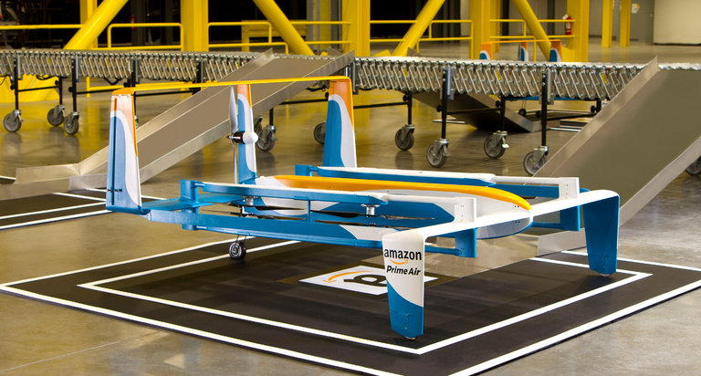
So what’s Amazon’s ultimate aim in delivery? After talking to analysts, partners and competitors, and prying some very minimal input from Amazon itself, I suspect the company has a two-tiered vision for the future of shipping.
First, it’s not trying to replace third-party shippers. Instead, over the next few years, Amazon wants to add as much capacity to its operations as possible, and rather than replace partners like UPS and FedEx, it is spending boatloads on planes, trucks, crowdsourcing and other novel delivery services to add to its overall capacity and efficiency.
Amazon’s longer-term goal is more fantastical — and, if it succeeds, potentially transformative. It wants to escape the messy vicissitudes of roads and humans. It wants to go fully autonomous, up in the sky. The company’s drone program, which many in the tech press dismissed as a marketing gimmick when Mr. Bezos unveiled it on “60 Minutes” in 2013, is central to this future; drones could be combined with warehouses manned by robots and trucks that drive themselves to unlock a new autonomous future for Amazon.
Drone Detects and Disarms Landmines 20 Times Faster Than Humans

A few years back, brothers and inventors Massoud and Mahmud Hassani unveiled a clever and widely-celebrated landmine clearing device resembling a giant dandelion puff that rolled over terrain like a tumbleweed, detonating and clearing landmines in its path. The rolling device called the mine kafon also had an onboard computer that logged the GPS locations of any discovered mines to help map areas that were likely heavy with landmines as well as safe paths.
ELECTRICITY BY DRONE
many companies are exploring drone delivery to get the job done. In areas where the power grid has been leapfrogged by home solar, solar-powered drones can be the final link in the supply chain, safely and reliably depositing orders directly to consumers — no roads or fossil fuels necessary. Each rooftop panel could become a charging station for delivery drones. The drones can make deliveries throughout a region while stopping to recharge on homes with charging stations connected to solar panels. Without having to go back to its home base, the deliveries are faster, more efficient, and cheaper. Plus, the customers get credit for the power that the drones sip from their panels.
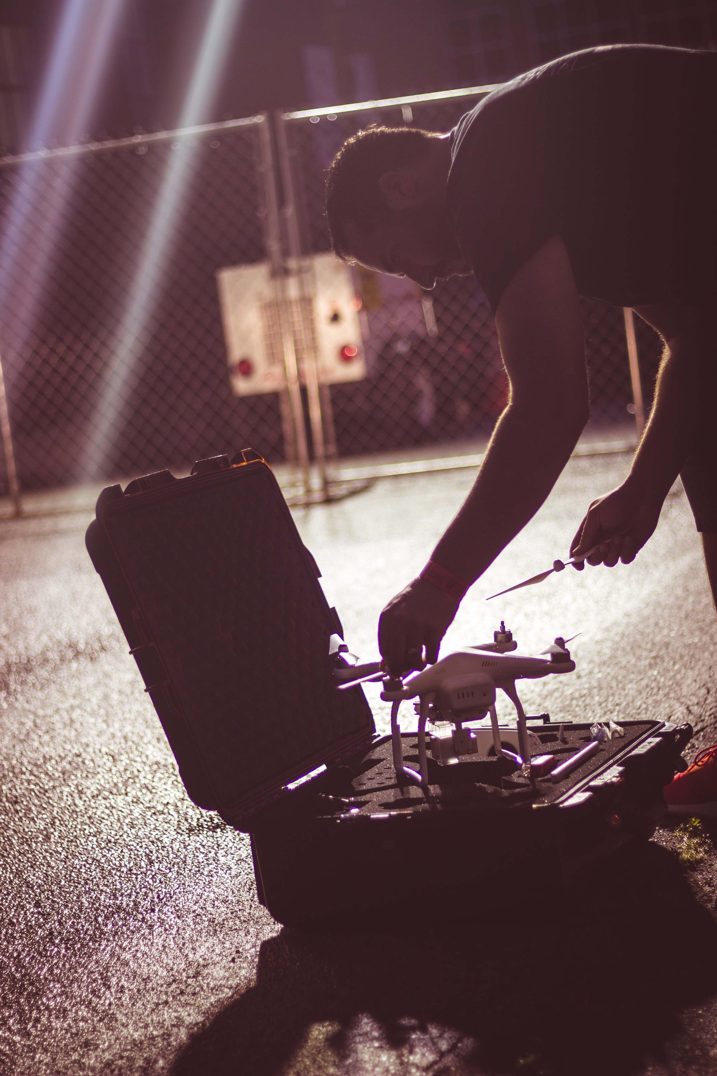
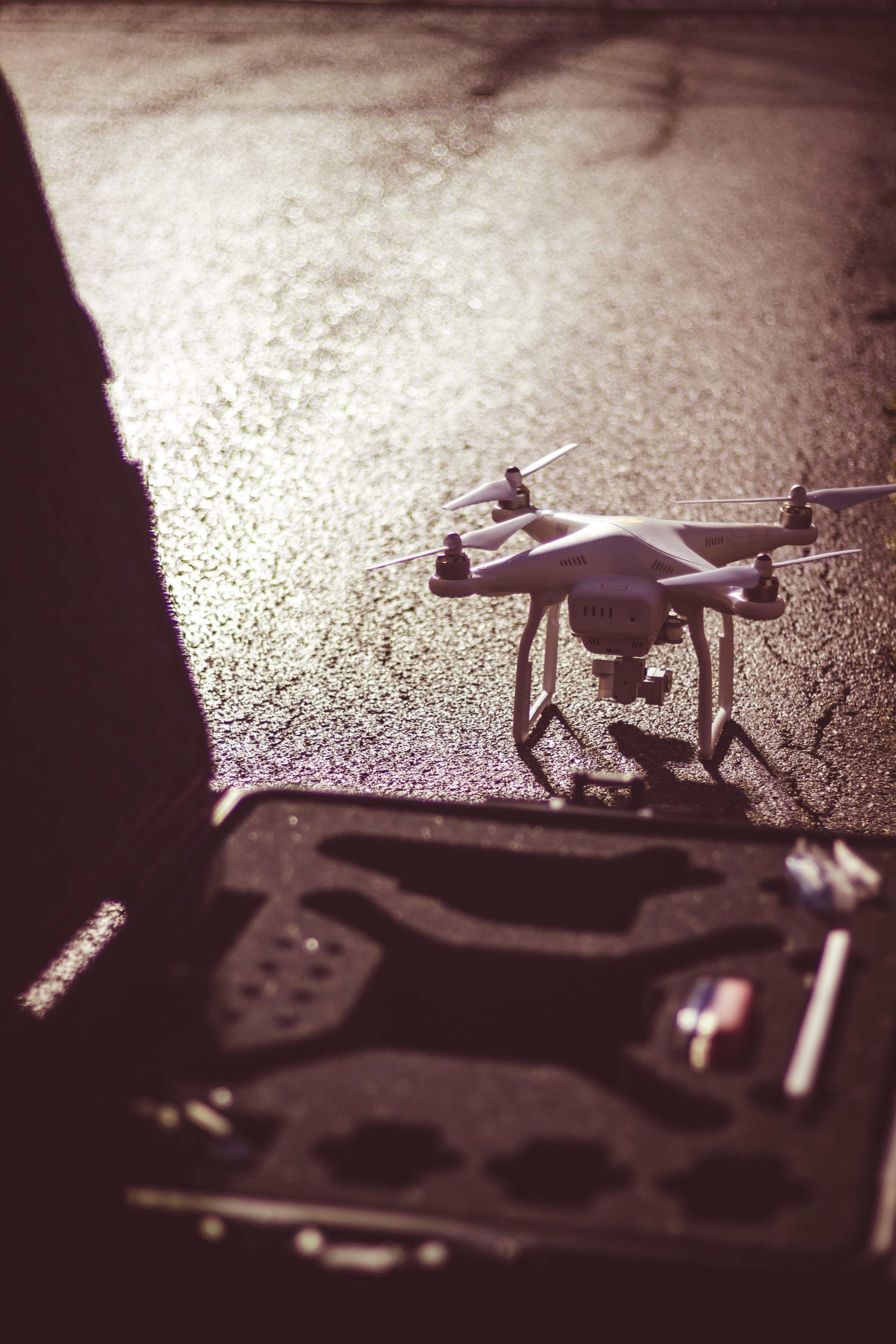
Fly a Drone Like a Pro

You’ll want to read this crash course in basic aircraft terminology, and how it relates to your drone’s controls.
Baals 2016 - Little Behind the Scenes


Cutting Edge of Drone Tech

A team of researchers deployed some of the most advanced drone technology available outside of the military this Wednesday — in Plainfield, a central Vermont town of just over 1,200 people.
The engineers, armed with the map, will then be able to make smarter, faster and safer repairs to bridges running over the stream than if they used conventional surveying methods to gather data.
Amazing Photos from the Sea


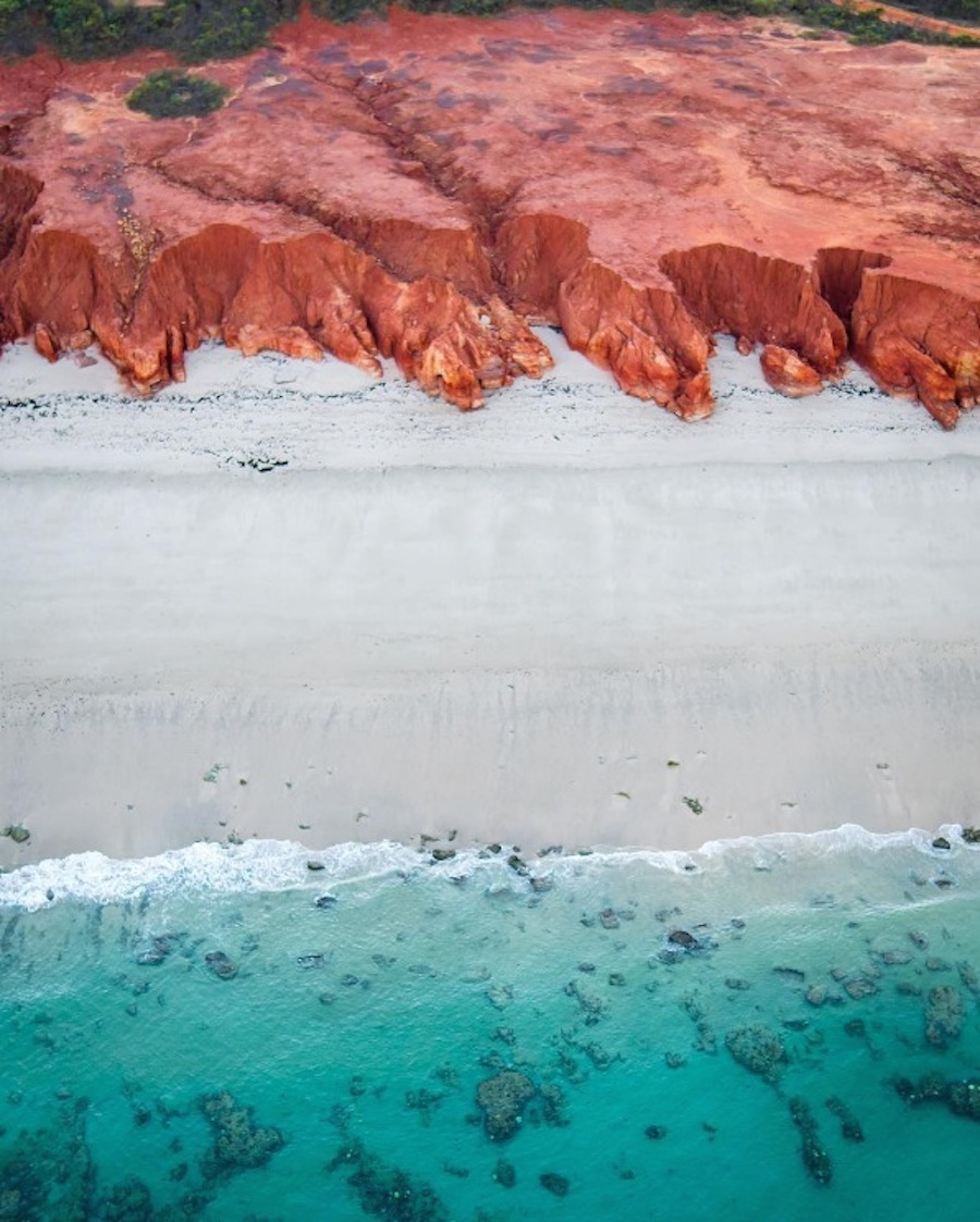
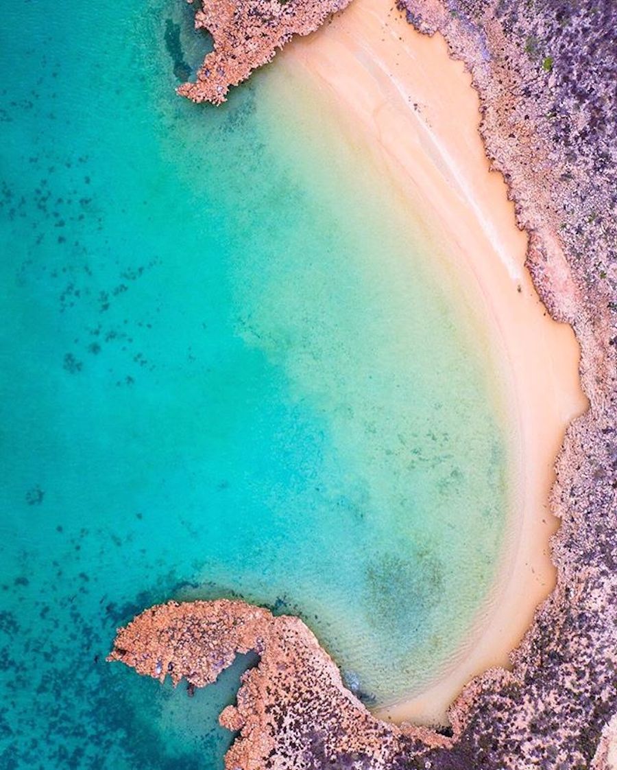

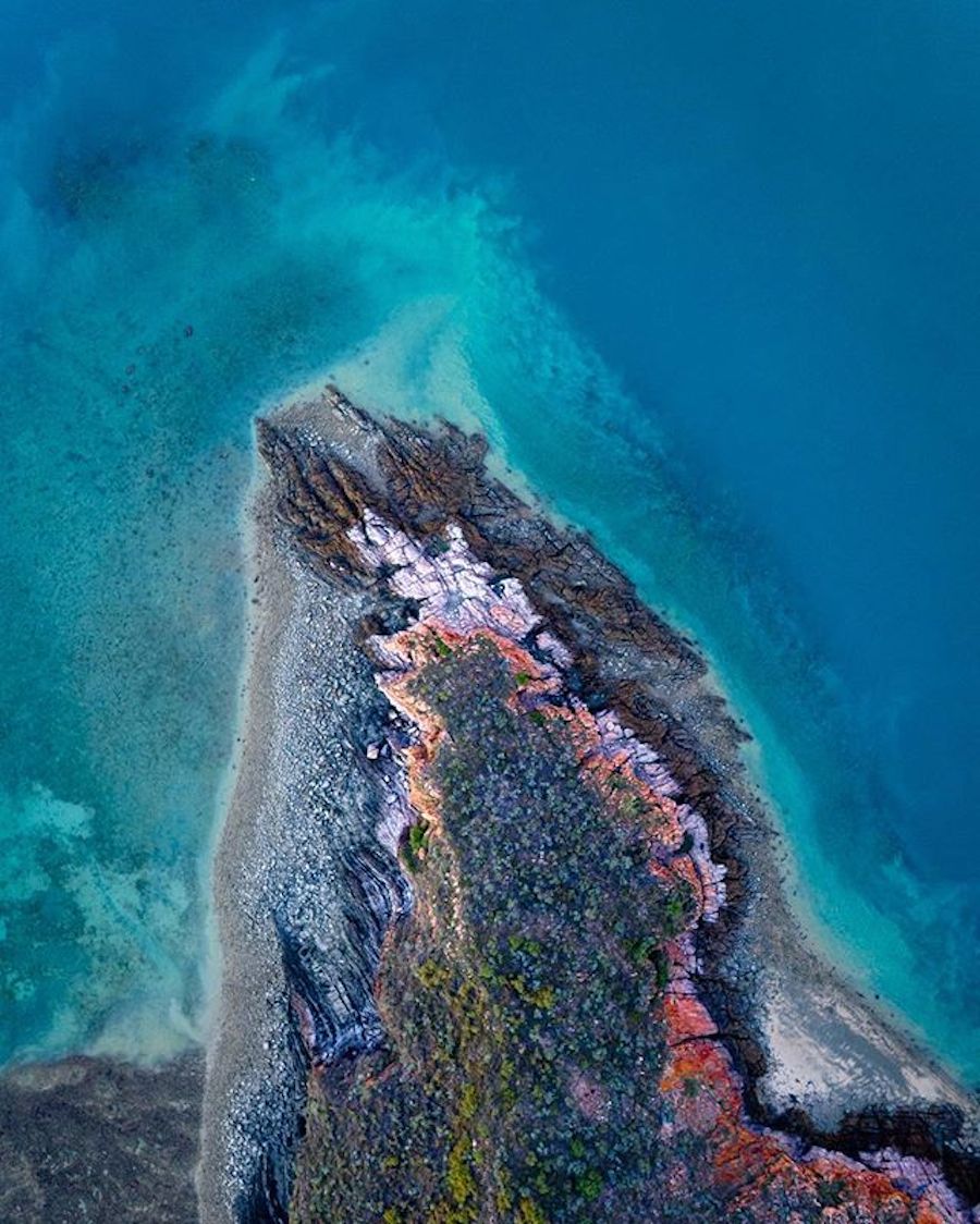

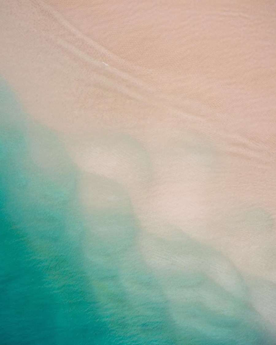
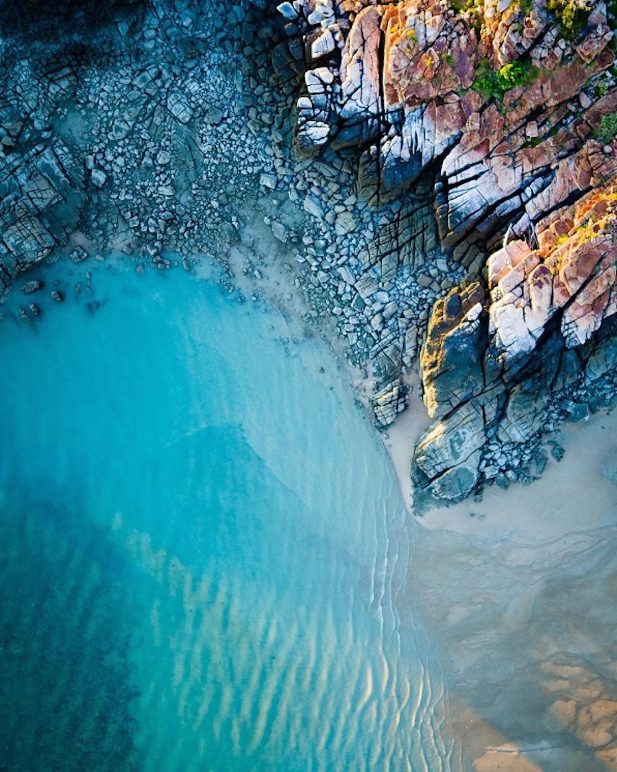
See more on SaltyWings
High-tech Tools Raise Quality of Real Estate Listings
According to the National Association of Realtors, 89 percent of all homebuyers use online tools and resources in their home search. Technology has changed nearly every aspect of the way we live, so it is only natural that it affects the way sellers and their Realtors market and sell homes. With so much high-quality media online, the bar has been raised for online real estate listings to really "wow" buyers.
Unmanned aerial vehicles, more commonly known as drones, can be used to take aerial photos of your home and the surrounding property. New drone technologies can help your agent market your home in a way that may have been cost-prohibitive in the past.
By using a few of these tools, you can make your home’s listing more appealing to buyers. Contact a Realtor today to see how these tech tools can be used to successfully sell your home.