
Drone racing is a sport still in its infancy. It is not yet clear whether it will become a massively popular sport. If it does, we could see very exciting advances coming from drone racing into both the toys that we fly in our living rooms and parks and into the drones used by professional videographers, engineers and scientists.
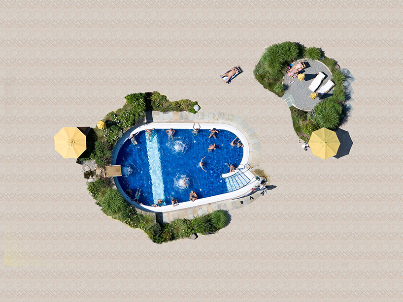
Landscape Photography by Drone

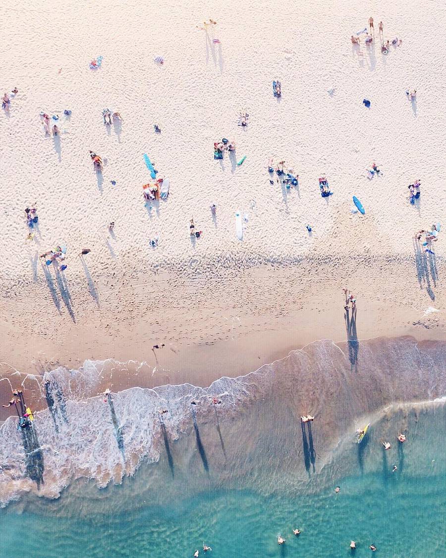


Beautiful landscape photography by drone.
Incredibly Beautiful Church by Drone
Neo Byzantine church captured by drone.
FAA Small Commercial Done Rule is Out
This should make it a hole lot easier to operate a commercail drone business leagaly.
https://www.faa.gov/news/press_releases/news_story.cfm?newsId=20515
FAA Leak

Could be a big day tomorrow for Drone regulation.
Sunny Coast East Coast Low Swells by Drone
Drone shot over one day at Sunshine Beach during the epic East Coast low swell.
Rare Whale Footage by Drone
Unique footage of a Bryde’s Whale has been released today by Auckland University of Technology. The footage shows an adult whale feeding, briefly joined by a young calf, and was filmed from a drone off the coast of Auckland. It is thought to be the first time the feeding behaviour of a Bryde’s Whale has been recorded by an Unmanned Aerial Vehicle (UAV).
Growers and Drone Mapping
Growers are using drone mapping in so many ways — for crop scouting, to generate variable rate prescription maps, to compare soil data to plant health, and much more. At the core, drone mapping helps growers detect variation in their fields.
Being able to see variation not only helps growers diagnose problems, but also helps them evaluate whether solutions are working. Using drone mapping on both fronts to help demonstrate the value of their products and boost sales.
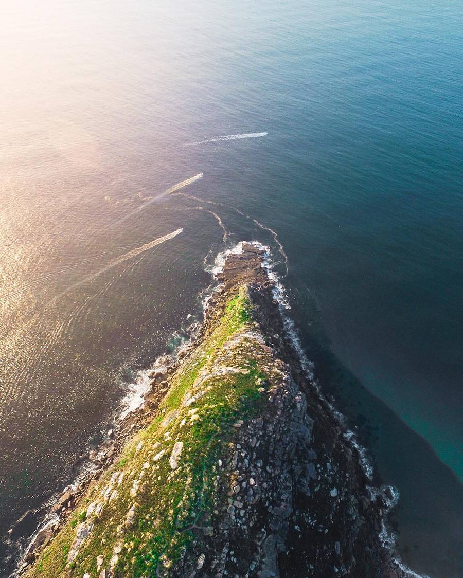
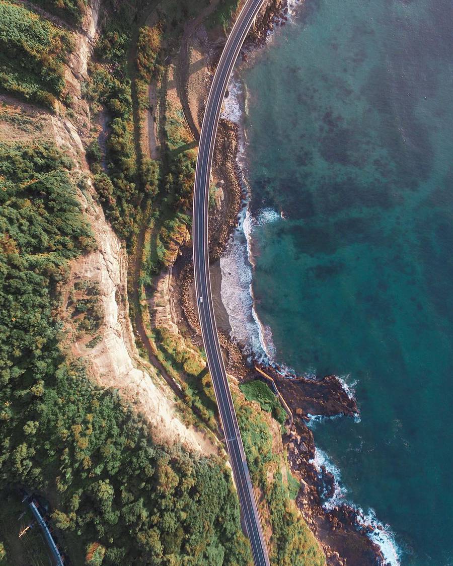
Top 10 Drone Photos Shared on 500px
10. Serpentine by Cliq asbl
9. Point of Ayr by James Farley
8. To the Dunes by NaSseT Alomari
7. Krakow – Poland [old city] by Adam Brzoza
6. Cabo San Lucas, Mexico by Romeo Durscher
5. Downtown Dubai by Alisdair Miller
4. Sunrise at Cheow Lan Lake, Thailand by Kaupo Kalda
3. Beyond The Vatican by Elia Locardi
2. A Man In a High Castle by Slava Mylnikov
1. Droneshot Over Iceland by Stefan Forster
#NYCDFF 2016
The New York City Drone Film Festival represents the best drone cinema in the world.
Thanks to all the amazing filmmakers who's work serves to guide the amazing art of aerial cinematography.
Aerial Views of India by Drone - In Pictures
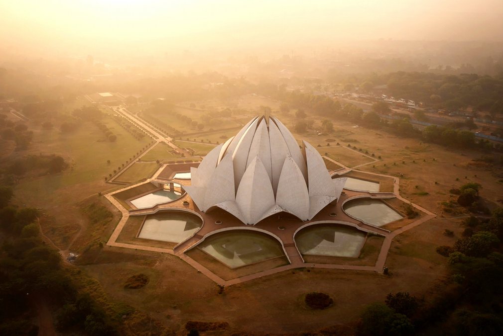
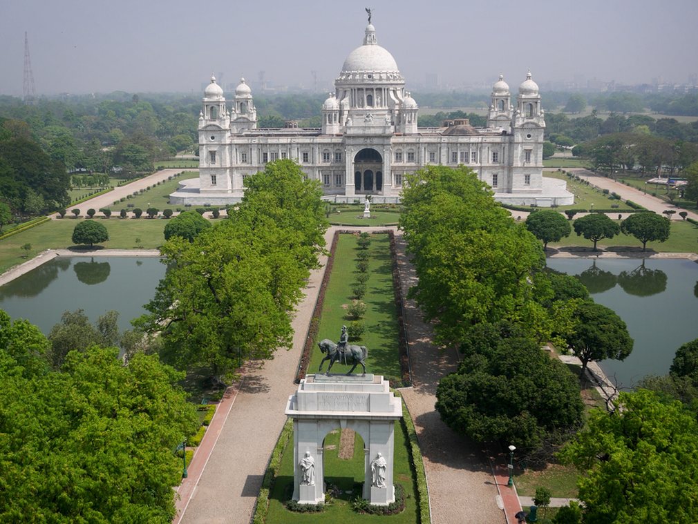
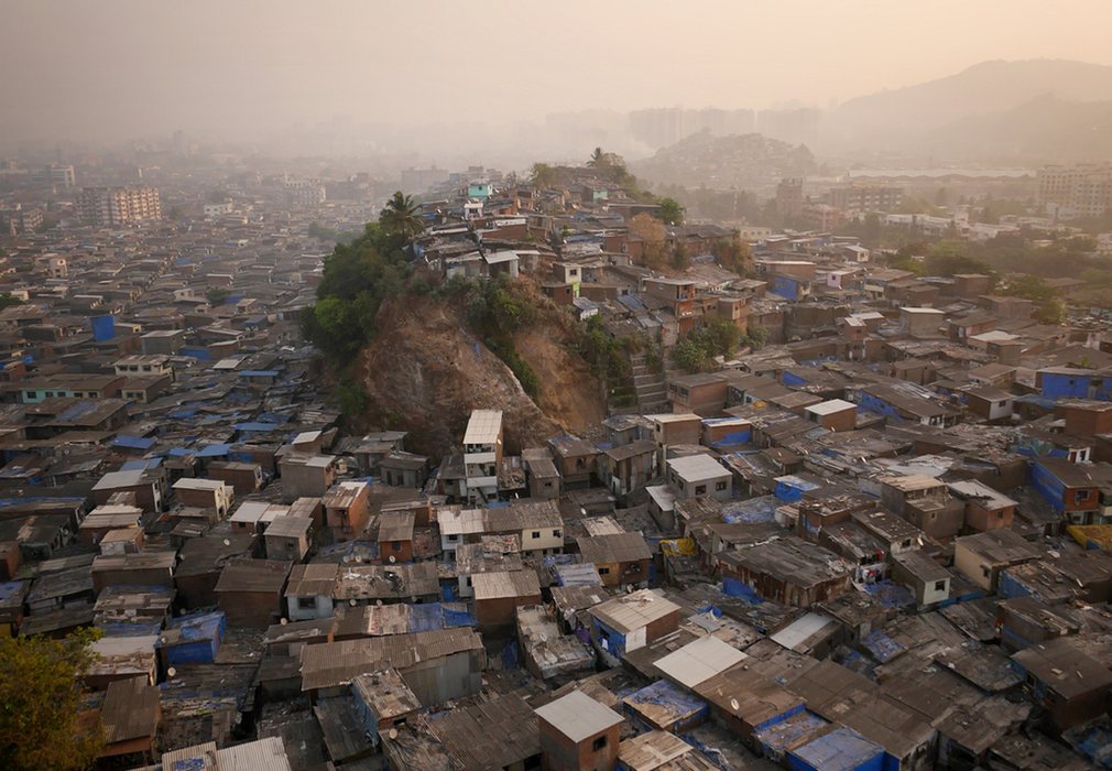

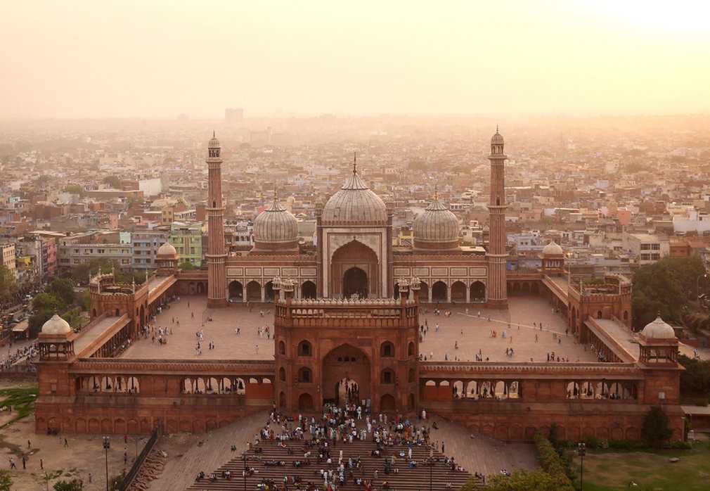
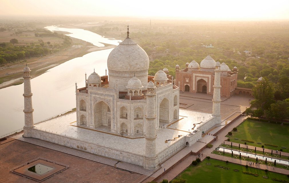
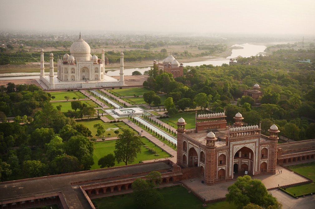
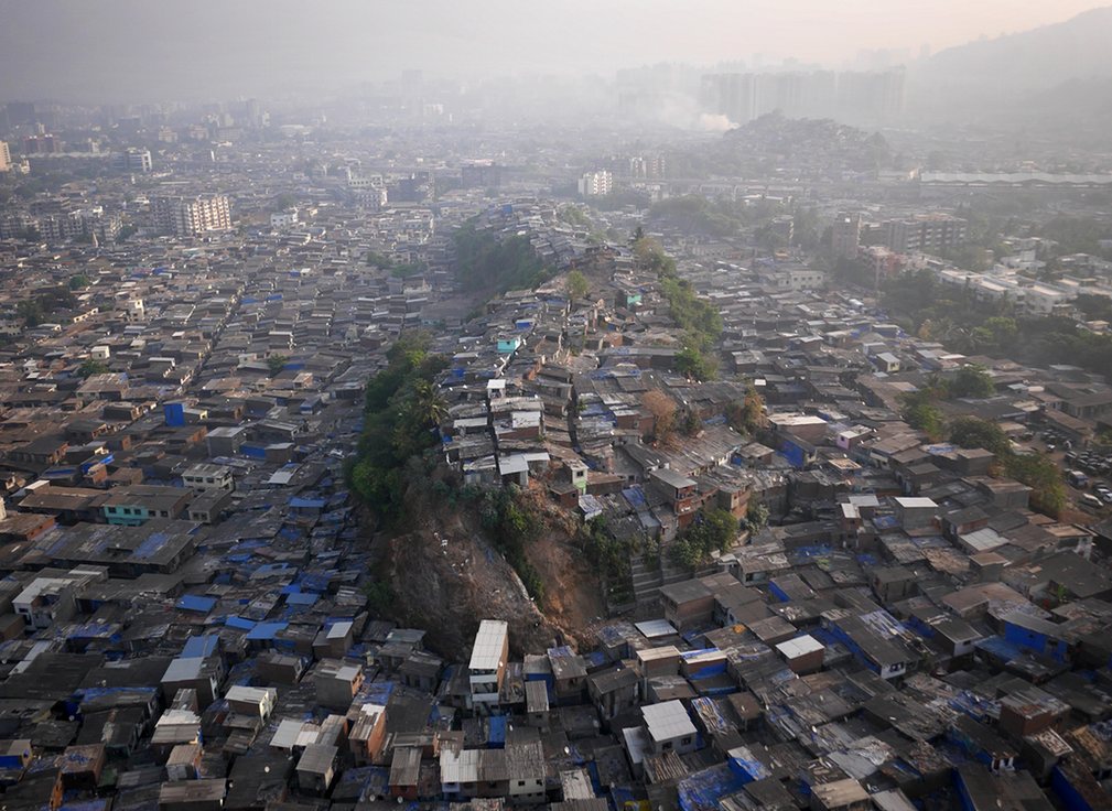
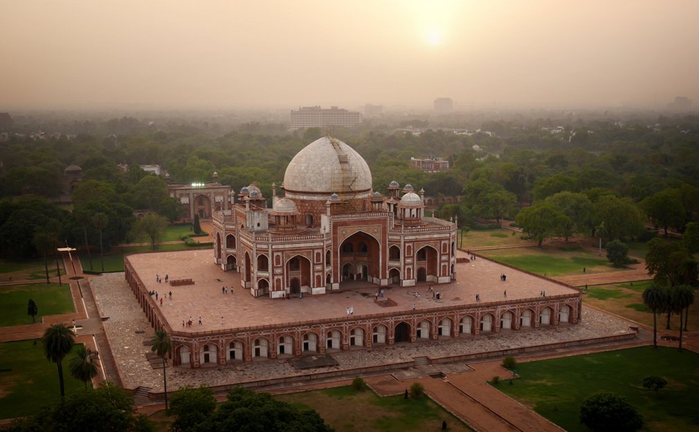
Photographer Amos Chapple's remarkable aerial views of India were shot by attaching his camera to a 'quadcopter' drone
Nintendo Power Glove Controling a Drone
This repurposed Nintendo Power Glove allows users to control drones with a flick of the wrist.

Engineering student Nolan Moore described the goal of the Power Glove as "to revamp the 1989 Nintendo Power Glove with modern sensors and wireless communication, giving you the ability to use gesture and motion controls with almost anything you can think of, in style."
Moore reengineered the glove, taking out its original electronic system and replacing it with a home-built one.
Via Wi-Fi, Moore can control a drone by moving his hand. Holding his hand flat, palm facing the ground, makes the drone hover, making a fist and tilting it in any direction affects "pitch and roll" and pointing a finger up or down affects altitude.
Moore is tracking the development of the project on his Hackaday page.
Sunset Above the Fog
Beautiful Drone Footage of British Columbia, Alberta and Yukon
Talk to a Realtor
Drones continue to explode in popularity. The small flying cameras have suddenly enabled thousands to get shots that only a few years back would have required a very expensive helicopter rental.
Many industries are starting to take note of the usefulness of drones. In particular, realtors are beginning to incorporate them into their work. The ability to quickly show an entire property from above is especially useful, particularly when one considers large, undeveloped rural properties that may be difficult or time-consuming to navigate on foot. The National Association of Realtors reports that 26 percent of realtors currently use drones in their work, with another 18 percent planning to in the future. Of those that do, 42 percent hire a professional. This means that currently, approximately 264,000 realtors are hiring drone pilots, with another 432,000 interested in using them in the future.
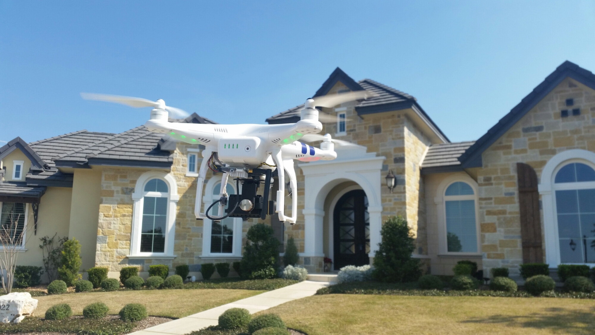
Drone Giant DJI Moves to the Farm
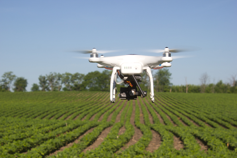
Farmers were some of the earliest civil adopters, using drones to identify differences in crop conditions.
Yamaha Motor Co. has been dusting crops in Japan with UAVs for more than two decades. With the cost dropping for cargo-carrying drones, DJI and others are building crop-spraying and remote sensing vehicles that can help reduce chemical use and improve yields. It has been estimated that precision agriculture will account for about 80 percent of the U.S. market for commercial UAVs.
Last year the U.S. Federal Aviation Authority issued the first exemption for agricultural drone use outside of university research. DJI released its eight-rotor Agras MG-1 last year, with a 10-kilogram tank, followed by a thermal-imaging camera for remote sensing. It’s up against companies like Yamaha and local rivals like Shenzhen MicroMultiCopter Aero Technology Co.
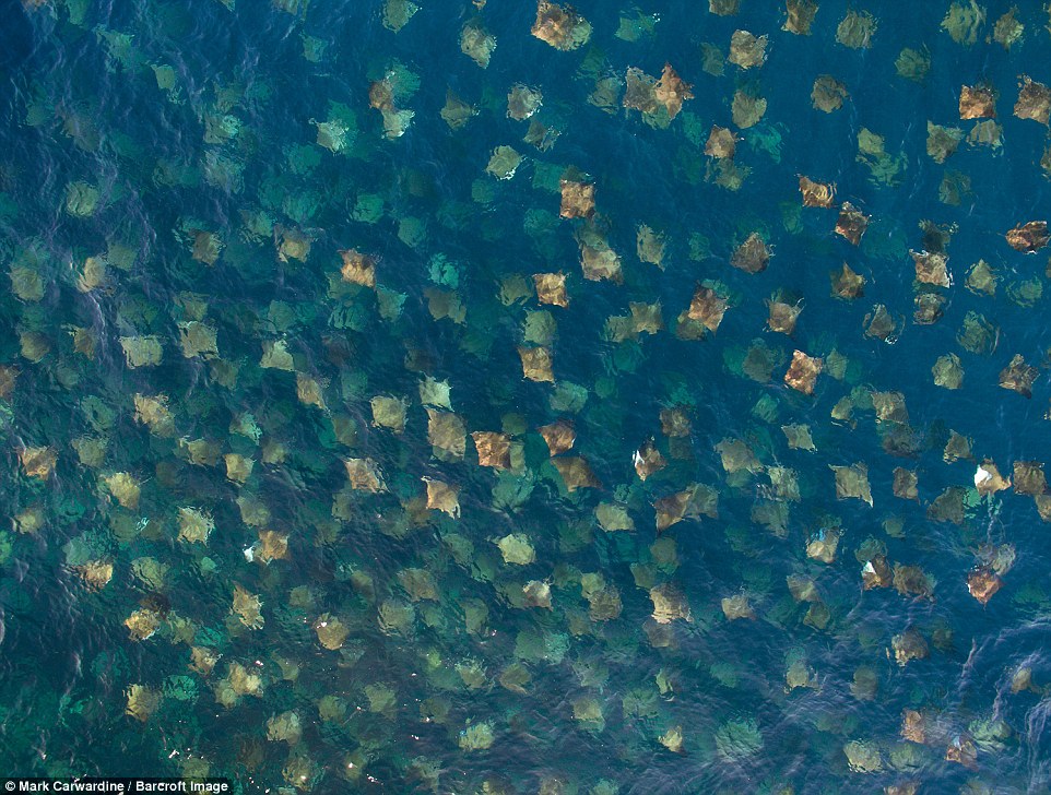
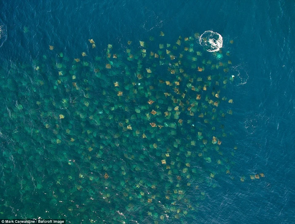
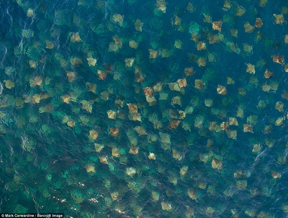
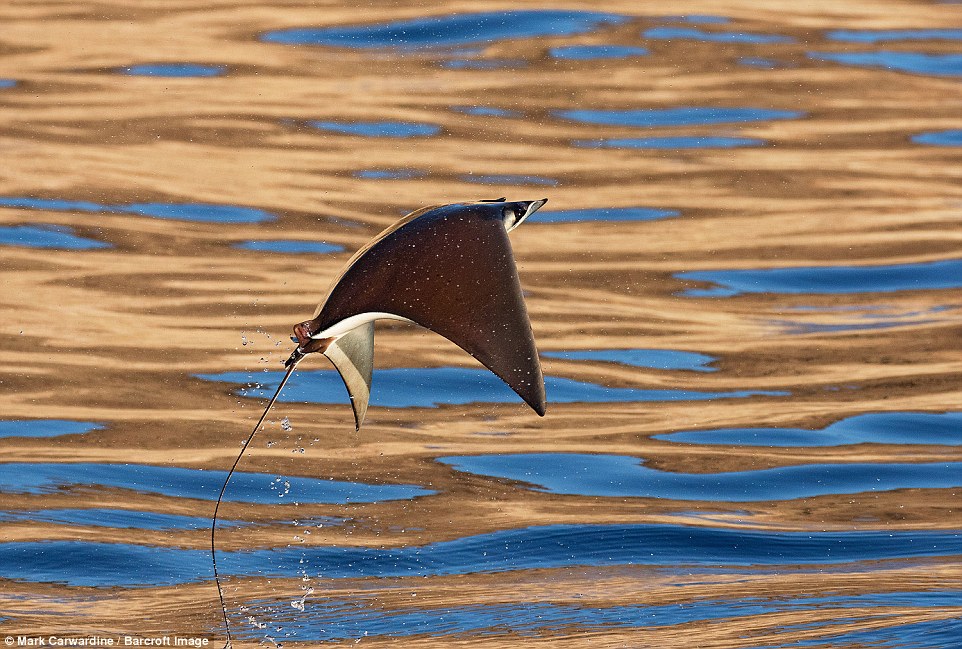
Incredible Drone Video and Photographs of Mobula Rays
A school of mobula rays seen swooping through the air in incredible drone video and photographs.
Amazing drone footage in Baja California, Mexico, captures the creatures huddled together in their hundreds before leaping into the air.
The rays appear as suited to the sky as they do to the water, performing some awe-inspiring aerobatic displays.


Life-saving Medicines . . . from a Drone
Rwandan will soon use drones to deliver life-saving blood supplies and rabies vaccine to health workers in the western half of the country.
The effort is part of an innovative collaboration between Zipline, a California-based robotics company; Gavi, the Vaccine Alliance; and UPS. The partnership could help save lives around the world.
Drone Art at Opiom Gallery
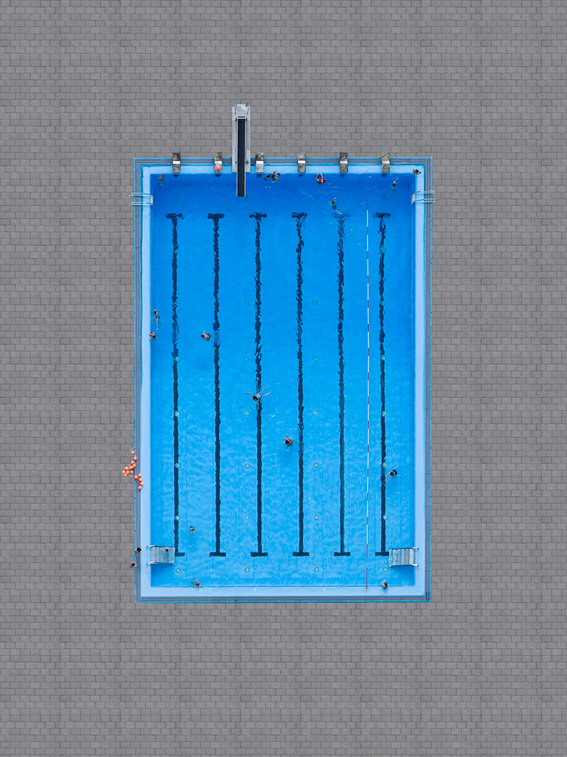
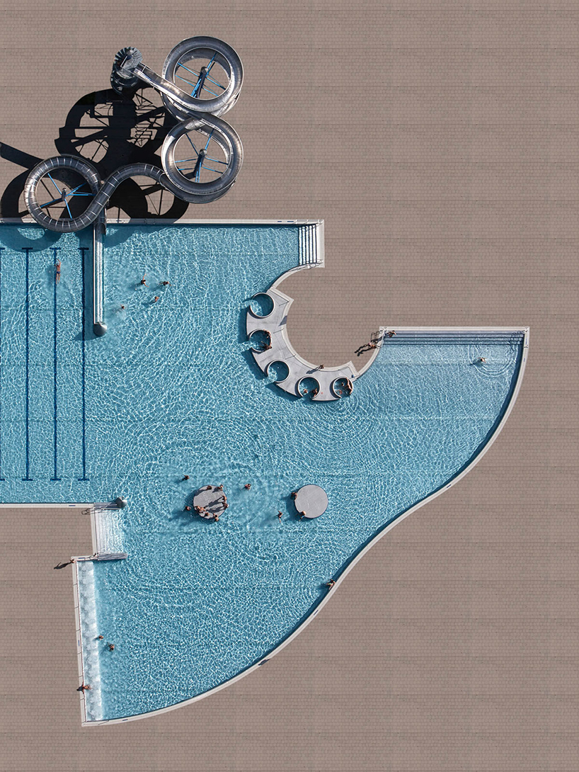
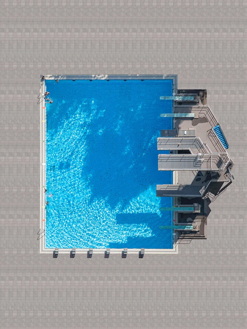
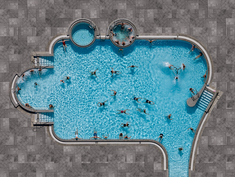
Stephan Zirwes' arial drone and photo footage at opiom gallery. From now until June 16th, 2016 Opiom gallery presents zirwes’ ‘moving stills’, a collection of images and recent video works filmed by an ultra high resolution drone exhibited for the first time in france. through the urban and natural landscapes he documents, zirwes forges contrasts and connections through the subject of his images.
Drone Video Capturing Sea Turtles Returning to the Water
Drone footage has captured the moment an endangered sea turtle returns to crystal clear waters after nesting on a beach in Costa Rica.